
Roque de los Muchachos: the roof of the island
Above the clouds
The winding drive to Roque de los Muchachos is part of the experience. From the coast, the road crosses several vegetation zones: trade-wind cloud may cling to the eastern slopes, the mist thins among the pines and eventually the tree line falls away. The destination stands at 2,426 metres, often above a solid sea of cloud.
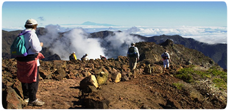
At the summit, the landscape becomes bare, spacious and almost detached from the rest of the island. Reddish rock, low high-mountain plants and an intensely blue sky replace the forest. There is noticeably less oxygen, the sun is stronger and the wind can feel cold even when the coast is warm.
On the rim of Caldera de Taburiente
Roque de los Muchachos rises from the northern rim of Caldera de Taburiente. On the inside, almost vertical walls fall into an immense basin shaped by erosion; on the outside, ravines run through the green north towards the Atlantic. On clear days, El Hierro, La Gomera and Tenerife may appear beyond Pico Bejenado and Cumbre Vieja, sometimes with only the summit of Teide above the clouds.
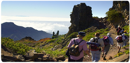
The ridge path once formed part of the arduous links between the north and the capital. At one point, a cross recalls a Palmero who, according to local tradition, was caught by an unusual snowfall and died on the summit. It is a quiet reminder that this altitude should not be underestimated despite the island’s mild climate.
A mountain devoted to astronomy
Close to the summit, at roughly 2,396 metres, stands the Roque de los Muchachos Observatory. Its white and silver domes form one of the world’s most comprehensive arrays of telescopes. Altitude, atmospheric stability, low light pollution and clean air make the site especially valuable for international solar and night-time research.
The observatory is an active scientific workplace. Public visits take place during the day, in small groups and only with advance booking; telescope operations and weather may affect them. The Instituto de Astrofísica de Canarias provides current information and booking access. The observatory is not open for tourist visits at night.
Routes and safe planning
From the summit area, visitors can choose short walks to viewpoints or demanding hikes along the ridge. The former description on this page followed roughly six kilometres towards Pico de la Cruz. This section forms part of stage two of the GR 131 and is not a separate circular walk, so a return route or collection must be arranged in advance.
The complete second stage of the GR 131 covers more than 26 kilometres between Roque de los Muchachos and Refugio del Pilar. Although it trends downhill, it includes continuous climbs and descents. Springs may be dry, while sun, wind, mist, cold or snow can change the challenge very quickly.
Before driving up, check trail conditions and the latest weather, alert and road-access information for the LP-4 and LP-403. Even a short ridge walk calls for sturdy footwear, warm windproof layers, sun and rain protection, ample water and a clearly arranged return journey.