
Cubo de la Galga: laurel forest and ravines
A forest from a fairy tale
Cubo de la Galga leads into a damp, almost enchanted forest in north-eastern La Palma. It lies within Las Nieves Natural Park and the island’s World Biosphere Reserve. Trade-wind cloud gathers on the slopes and supplies the ravine with moisture. Laurels, ferns and climbing plants therefore grow so densely that the vegetation can resemble a small jungle.
Laurel forest is an ancient subtropical formation related to woodlands that grew across parts of southern Europe and North Africa millions of years ago. It survived in the humid mid-altitudes of the Canary Islands. Fruit trees, wax myrtle and tree heath appear near the start; farther in, signs of human use gradually fade beneath an increasingly closed canopy.
Inside green Barranco de La Galga
The path winds beside damp rock walls covered with ivy, moss and long trailing plants. Beneath the closed canopy, the air stays cool and the light is filtered. Often the only sounds are moving leaves or forest pigeons; only occasionally do the trees reveal the depth of the evergreen ravine.
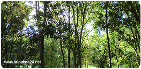
This quiet atmosphere is one of the main pleasures of the short circuit. Even so, it remains a woodland path: roots, stones and damp patches can be slippery. It should not be attempted after heavy rain or when a large volume of water is flowing through the ravine.
Asomada Alta and San Bartolomé
Hikers choosing the longer variant climb out of the enclosed ravine towards tracks and viewpoints. In clear air, Asomada Alta looks across north-eastern La Palma, from forested slopes to deeply cut ravines and the Atlantic. San Bartolomé, also known locally as San Bartolo, stands in the transition between these mountains and the coast.
The vegetation changes with decreasing altitude. Wax myrtle and tree heath give way to fruit trees, gardens and plots growing potatoes, maize, vegetables or ornamental flowers. Continuing towards Playa de Nogales becomes a separate and much longer outing that requires precise route and return-transport planning.
Short circuit or the full PR LP 05.1
For a first visit, the easiest choice is the waymarked circuit through the laurel forest: about five kilometres, roughly two hours and low difficulty. It starts at the Environmental Information Point car park beside the LP-1 and returns to the same place.
The full PR LP 05.1, at 12.4 kilometres with around 750 metres of ascent, is considerably more demanding. It links the Cubo with Montaña de La Galga, the main road and the GR 130, allowing onward routes towards Puntallana or Los Sauces.
Waymarking and temporary diversions take priority over older maps. Before setting out, check the current status of the island trail network. Sturdy footwear, a waterproof layer, water and some food are sensible even in this shaded forest.