
Caldera de Taburiente: hiking in the national park
A natural experience in the heart of La Palma
Caldera de Taburiente is La Palma’s great hiking classic. This immense mountain amphitheatre was not formed by one crater, but by volcanic construction, a gigantic landslide and relentless water erosion. Almost two thousand metres of relief, rock walls, deep ravines and springs create a world of their own in the island’s interior. It has been protected since 1954 as one of Spain’s earliest national parks.
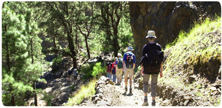
The classic entrance starts at Los Brecitos. From there the path follows a soft carpet of pine needles beneath mature Canary pines. Lomo de Tagasaste provides the first broad view across the basin, its rocky pinnacles and surrounding peaks. Canary pine dominates this landscape, and its thick bark allows it to survive many forest fires.
From Los Brecitos to Playa de Taburiente
The official Los Brecitos–camping area section is 5.6 kilometres long and takes roughly one and a half to two hours. It descends gently for most of the way, crossing small ravines and passing springs whose flow varies with the season. A signed detour leads to an archaeological site with channels and cup marks carved into the rock.
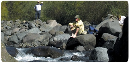
At Playa de Taburiente the stream spreads across a bed of rounded stones. Water disappears between the rocks and emerges again where the deposits become shallower, with Canary willows growing in the damper ground. The camping area and service centre stand across the stream. Overnight stays are allowed only in the designated area and require advance permission.
Idafe, Dos Aguas and the power of water
The slender outline of Roque Idafe repeatedly appears along the historic descent. It was a sacred place for the Benahoaritas, La Palma’s pre-Hispanic inhabitants. Below the camping area, the terrain enters Barranco del Almendro Amargo, where mineral-rich water colours the rocks yellow, orange and green.
At Dos Aguas, the Taburiente stream and Almendro Amargo meet to form Barranco de Las Angustias. Erosion exposes the island’s interior here: vertical dykes, iron-rich deposits, ancient rocks and pillow lavas that cooled beneath water. Walking in the stony channel requires steady footing and can become extremely dangerous after rain because water levels rise rapidly.
Current trail status and route planning
The classic day hike links Los Brecitos, Playa de Taburiente, Dos Aguas and the Barranco de Las Angustias car park. Depending on detours, it covers roughly 13 to 16 kilometres and takes six to seven hours. Hikers normally leave their car at Las Angustias and use a shared taxi to Los Brecitos. Seats, departure times and the return journey should be arranged in advance.
The through-hike cannot currently be completed: Los Brecitos–camping area is open, but the section from the camping area to Cascada de Colores is closed. Only Cascada de Colores–Las Angustias car park is listed as open. Immediately before setting out, check the latest official national park trail status and never attempt to bypass a closure.
Choose only an open out-and-back route and settle transport arrangements first. The park’s official itineraries help adapt the visit. Rain, wind and rockfall can alter access quickly. Bring hiking boots, water, food, sun protection and a warm or waterproof layer; dogs and other introduced animals are not allowed inside the national park.