
El Time and Tazacorte: from viewpoint to Atlantic
A balcony above the Aridane Valley
El Time viewpoint stands beside the LP-1 almost 700 metres above La Palma’s west coast. Its terrace overlooks the Aridane Valley, banana plantations, Barranco de Las Angustias, Puerto de Tazacorte and a wide sweep of Atlantic Ocean. On clear days the outline of El Hierro can also be seen.
The landscape created by the 2021 eruption of Tajogaite now forms part of this panorama. Its cone and dark lava fields reveal how profoundly the valley changed, while irrigated plantations, settlements and the ocean continue to define the wider view.
Along the old royal path
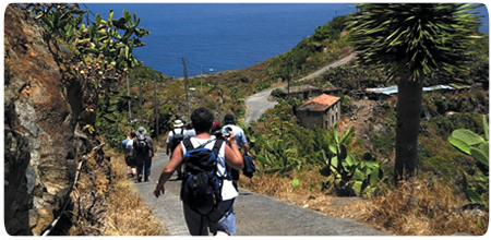
From the viewpoint, the old Camino del Time zigzags down towards the coast. Parts of this royal path are still cobbled, and for at least five centuries it linked the harbour with the north and north-west of the island. Its history reaches further back: the rock walls and caves nearby offered natural shelter to the Benahoaritas before the Castilian conquest.
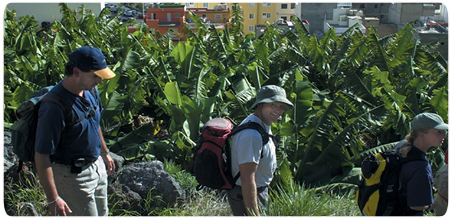
The surroundings change with every metre of descent. Dry slopes with spurges and prickly pears give way to terraces and banana plantations, while each bend opens a new view towards the cliffs and the mouth of Barranco de Las Angustias. This succession of landscapes gives the short route unusual variety.
Tazacorte between plantations and sea
At the bottom lies Puerto de Tazacorte, a coastal settlement with a harbour and black-sand beach. Its sheltered position on the western side generally brings warm, sunny conditions. Fishing boats, the breakwater and colourful houses contrast sharply with the steep path that only moments earlier ran high above the village.
Puerto de Tazacorte and the inland Villa de Tazacorte are separate settlements. With enough time, a walk to the harbour can be combined with the historic centre of the Villa. Banana plantations stretch between them and continue to shape both the economy and scenery of the lower Aridane Valley.
Distance, return journey and current status
The route between El Time and Puerto de Tazacorte is about three kilometres long and takes roughly one hour each way; a return walk is around six kilometres. It is short but covers almost 700 metres of elevation on sunny, loose and sometimes cobbled ground. Sturdy footwear, water and sun protection are essential. Hikers walking downhill only should arrange return transport in advance.
This coastal path is also the beginning or end of the first GR-131 stage. The complete Puerto de Tazacorte–Roque de los Muchachos stage is a very different undertaking: 16.9 kilometres with an extreme ascent. It should not be confused with the short Camino del Time.
Following improvement works, the Puerto de Tazacorte section reopened on 10 July 2026. Weather, rockfall or further works may nevertheless alter access at short notice. Before setting out, check the current status of the island trail network and always follow closures and waymarking on the ground.